

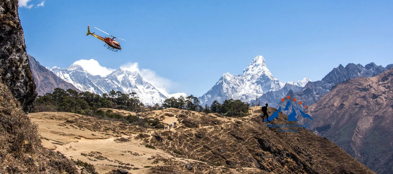

The Khumbu Valley is one of the most recognizable mountain landscapes in Nepal. Its deep valleys, steep slopes, rocky ridges, and glacier-covered mountains create the setting for the Everest trekking route. These features did not appear overnight. They developed through millions of years of geological activity, including movements of the Earth’s crust, erosion, and the movement of ice.
During the Everest Base Camp Trek with Helicopter Return, travelers pass through landscapes shaped by these natural forces. From the river valleys near Phakding to the rocky terrain around Gorakshep, the route provides a close look at how a high Himalayan valley changes with elevation.
The Geological Forces Behind the Himalayas
The Himalayas formed because the Indian tectonic plate moved northward and collided with the Eurasian plate. This collision began millions of years ago and continues to influence the region today.
The pressure created by this movement pushed rock layers upward, helping form the enormous mountain range.
Why the Mountains Are Still Changing
The Himalayan region remains geologically active. Tectonic forces continue to affect the Earth’s crust, while earthquakes can reshape slopes and mountain terrain.
Weathering and erosion also gradually break down exposed rock. Rain, freezing temperatures, flowing water, and moving glaciers all contribute to these changes.
How Rivers Cut Deep Mountain Valleys
Rivers are important forces in shaping the Khumbu landscape. Flowing water gradually removes loose soil, sediment, and fragments of rock from mountain slopes.
Over long periods, this process helps deepen and widen valleys.
The Role of the Dudh Koshi River
The Dudh Koshi River is an important geographical feature along the lower trekking route. Its river system receives water from glaciers, snowmelt, and smaller mountain streams.
The trail follows sections of this river valley, especially around Phakding and the route toward Namche Bazaar.
River erosion has helped create the steep valley walls and narrow passages that make this part of the journey so distinctive.
How Glaciers Shape the Upper Khumbu Landscape
Glaciers are large bodies of ice that move slowly under their own weight. As they travel downhill, they can carry rocks, scrape exposed surfaces, and transport sediment.
These processes leave visible marks across the upper Everest region.
The Formation of Glacial Valleys
Moving glaciers can create broad valleys with relatively flat floors and steep sides. These are often called U-shaped valleys because of their cross-sectional appearance.
This differs from many river-cut valleys, which tend to have narrower V-shaped profiles.
The upper Khumbu region contains landscapes influenced by both glacial movement and flowing water.
Moraines: Natural Ridges of Rock and Sediment
Moraines are deposits of rock, soil, and other material carried and left behind by glaciers.
They may appear as uneven ridges or piles of debris near glacier edges and former glacier positions.
Why Moraines Matter Near the Trekking Route
Moraines are visible in parts of the upper Khumbu landscape, including areas around the Khumbu Glacier.
They provide evidence of past glacier movement and changing ice boundaries.
Travelers should avoid climbing unstable piles of loose material. Some moraine surfaces contain shifting stones and uneven ground that can make walking difficult.
Why the Landscape Around Lobuche and Gorakshep Looks Different
As the route moves above Dingboche, vegetation becomes increasingly limited. The trail passes through exposed slopes, rocky ground, and glacial terrain.
Near Lobuche and Gorakshep, the landscape has a much harsher appearance than the greener valleys around Phakding.
Understanding the Change
Several factors contribute to this difference:
-
Lower temperatures at higher elevations.
-
Reduced plant growth.
-
Stronger exposure to wind.
-
Steep rocky slopes.
-
The influence of glaciers and glacial deposits.
The Everest Base Camp Trek with Helicopter Return follows this natural transition from river valleys to a high-altitude environment shaped by ice and rock.
Freeze-Thaw Weathering on Mountain Slopes
Mountain rocks experience repeated changes in temperature. Water can enter small cracks, freeze during cold conditions, and expand. Repeated freezing and thawing can gradually break rock into smaller pieces.
This process is known as freeze-thaw weathering.
How It Changes the Trail
Broken rock fragments can collect on slopes and along trekking paths. Loose stones may also move downhill because of gravity, rain, or other environmental forces.
This is one reason rocky mountain trails require careful footing. Travelers should follow the guide’s instructions around loose slopes and avoid standing beneath unstable rock faces.
Glacial Meltwater and the Changing River System
Glaciers store water in the form of ice and release some of it through melting. This meltwater contributes to streams and rivers throughout the Himalayan region.
The amount of meltwater can change with temperature, season, and weather conditions.
Why Meltwater Is Important
Glacial meltwater supports river systems and helps transport sediment through mountain valleys.
However, glacier-related water sources are not automatically safe to drink. Sediment, microorganisms, and other contaminants may be present. Travelers should use treated drinking water from reliable sources.
Observing Geological Features Responsibly
The geological landscape is one of the most valuable natural features of the Everest region. Travelers can observe rock formations, river channels, glacial deposits, and changing valley shapes without disturbing them.
Simple Ways to Protect the Terrain
-
Remain on established trekking paths.
-
Avoid removing rocks or natural materials.
-
Do not climb unstable moraine ridges.
-
Keep rubbish away from rivers and glacier areas.
-
Follow local park rules and guide instructions.
-
Avoid approaching dangerous glacier edges.
Responsible behavior helps protect both the natural environment and the safety of people traveling through it.
The Everest Base Camp Trek with Helicopter Return crosses landscapes that continue to change through natural processes. Observing these features from safe locations provides a better understanding of the region’s geological history.
Final Thoughts
The Khumbu Valley is the result of powerful geological forces operating over millions of years. Tectonic movements helped raise the Himalayas, while rivers, glaciers, and temperature changes gradually shaped their valleys and slopes.
From the Dudh Koshi river system to the rocky terrain near Gorakshep, the trekking route reveals different stages of this natural process. During the Everest Base Camp Trek with Helicopter Return, understanding the landscape’s formation adds geographical meaning to the journey and highlights why protecting this fragile mountain environment matters.
Frequently Asked Questions
1. How were the Himalayas formed?
The Himalayas developed through the collision of the Indian and Eurasian tectonic plates, which pushed large areas of rock upward over millions of years.
2. What river flows through the lower Khumbu region?
The Dudh Koshi River is a major river system along the lower part of the trekking route.
3. What is a moraine?
A moraine is a deposit of rock and sediment transported and left behind by a glacier.
4. Why is the terrain near Gorakshep so rocky?
The area is located at high elevation, where vegetation is limited and glacial processes, erosion, and freezing conditions influence the landscape.
5. Is glacial meltwater safe to drink?
Not without proper treatment. Meltwater can contain microorganisms and sediment, so travelers should use reliable treated water sources.